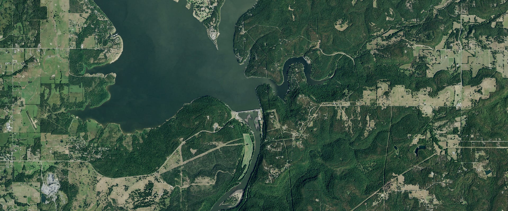
Fort Gibson Lake Water Level Today
1.2 ft above full pool, 2.7% of the flood pool in use, and 0.2 ft higher than a year ago.
Read Oct 26, 3:00 PM CDT
Trend and source week, month, year
Source: U.S. Army Corps of Engineers. Check it at www.swt-wc.usace.army.mil/FGIB.lakepage.html
Which Fort Gibson Lake ramps work at 555.2 ft
22 of 37 ramps are usable at today's level, 0 marginal and 2 out of the water. This is our own comparison of today's level with each ramp's pool range in the Corps' data; the Corps doesn't publish an official minimum pool, so treat it as a guide and check with the park.
- Blue Bill Point Usable
2 lanes · works with the lake between 553 and 558 ft
- Chouteau Bend Middle Usable
1 lane · works with the lake between 553 and 560 ft
- Chouteau Bend North Usable
1 lane · works with the lake between 553 and 560 ft
- Chouteau Bend South Usable
2 lanes · works with the lake between 553 and 560 ft
- Dam Site East Usable
1 lane · works with the lake between 553 and 560 ft
- Flat Rock Creek North Usable
1 lane · works with the lake between 553 and 557 ft
- Flat Rock Creek South Usable
1 lane · works with the lake between 553 and 557 ft
- Jackson Bay Usable
1 lane · works with the lake between 553 and 560 ft
- Jackson Bay Marina Boat Ramp Access Usable
1 lane · works with the lake between 554 and 557 ft
- Long Bay Landing Boat Ramps Usable
2 lanes · works with the lake between 553 and 558 ft
- Mallard Bay Usable
1 lane · works with the lake between 554 and 557 ft
- Mazie Landing Usable
2 lanes · works with the lake between 553 and 558 ft
- Mission Bend Usable
1 lane · works with the lake between 553 and 558 ft
- Rocky Point Usable
4 lanes · works with the lake between 553 and 558 ft
- Sequoyah Bay Usable
3 lanes · works with the lake between 554 and 570 ft
- Taylor Ferry North Usable
4 lanes · works with the lake between 553 and 567 ft
- Taylor Ferry South Usable
1 lane · works with the lake between 553 and 560 ft
- Toppers Usable
1 lane · works with the lake between 553 and 558 ft
- Wahoo Bay Campground Usable
1 lane · works with the lake between 554 and 558 ft
- Wahoo Bay East Usable
1 lane · works with the lake between 553 and 560 ft
- Whitehorn Cove Usable
2 lanes · works with the lake between 553 and 557 ft
- Wildwood Usable
1 lane · works with the lake between 553 and 558 ft
- Dam Site Out of water
1 lane · works with the lake between 490 and 495 ft
- Jackson Bay Marina North Out of water
1 lane · works with the lake between 557 and 554 ft
- Big Hollow
1 lane · works with the lake between 0 and 0 ft
- Earbob
1 lane · works with the lake between 0 and 0 ft
- Methodist Camp
0 lanes · works with the lake between 0 and 0 ft
- Muskogee Boat Club
1 lane · works with the lake between 0 and 0 ft
- Pelican Point Marina
1 lane · works with the lake between 0 and 0 ft
- Sequoyah State Park
2 lanes · works with the lake between 0 and 0 ft
- Sequoyah State Park Cherokee Campground
2 lanes · works with the lake between 0 and 0 ft
- Sequoyah State Park North East
1 lane · works with the lake between 0 and 0 ft
- Sequoyah State Park Paradise Come Marina
1 lane · works with the lake between 0 and 0 ft
- Sequoyah State Park South East
2 lanes · works with the lake between 0 and 0 ft
- Sequoyah State Park South West
1 lane · works with the lake between 0 and 0 ft
- Spring Creek
2 lanes · works with the lake between 0 and 0 ft
- Spring Creek East
1 lane · works with the lake between 0 and 0 ft
Ramp locations and pool ranges: U.S. Army Corps of Engineers (district GIS layers); the status is Creek & Lake's computation. Level: read Oct 26, 3:00 PM CDT.
Fort Gibson Lake, Oklahoma. Run by USACE Tulsa District.
Fort Gibson Lake level
Daily level, past 12 months, feet above sea level (NGVD29). Shaded: the normal range, the middle half of readings for each date, 2015 to 2025. U.S. Army Corps of Engineers.
Monthly average since Sep 21, 2014; gaps where the record is missing. U.S. Army Corps of Engineers.
About Fort Gibson Lake today
How full is Fort Gibson Lake?100.0% full, 1.2 ft above full pool
100.0% full by storage on Oct 26. Conservation pool between the top of inactive pool and the top of conservation, as the Tulsa District's lake pages define "Conservation pool is X% full".
Full pool is 554.00 ft, the operator's target for this time of year.
How low is Fort Gibson Lake?4.2 ft above its lowest since 2014
1.2 ft above full pool. The lowest daily level in our record since 2014 is 551.05 ft, on Oct 17, 2020.
Is Fort Gibson Lake still dropping?Yes: down 0.24 ft this week
| Change | Feet | Level then |
|---|---|---|
| Past day (since Oct 25) | 0.11 up | 555.12 |
| Past 7 days (since Oct 19) | 0.24 down | 555.47 |
| Past 30 days (since Sep 26) | 0.86 up | 554.37 |
| Past year (since Oct 26, 2025) | 0.24 up | 554.99 |
Is Fort Gibson Lake normal for this time of year?0.3 ft below normal for this date
Normal for Oct 26 is 555.50 ft: the median of 77 daily readings within 3 days of this date, 2015 to 2025. Fort Gibson Lake is 0.3 ft below it.
What is the water temperature at Fort Gibson Lake?No official reading for this lake
No USGS in-lake water-temperature gauge found within the lake area (checked 2026-10-24). Stream gauges above or below the dam were not used: tailwater and inflow temperatures differ from the lake surface.
When was Fort Gibson Lake last full?It's full now
The last day in our record at or above 554.00 ft, today's full pool.
Fort Gibson Lake full pool level554.00 ft
Full pool changes with the season; this is the operator's target for today. Elevations are feet above sea level (NGVD29).
Where it comes from: USACE CWMS location level "FGIB.Elev.Inst.0.Top of Conservation" (refreshed daily; seasonal where the Corps sets a seasonal pool). Checked 2026-10-24.
Fort Gibson Lake this time last year555.0 ft on Oct 26, 2025
0.2 ft higher than a year ago.
Levels: U.S. Army Corps of Engineers, read Oct 26, 3:00 PM CDT. Normal and records come from Creek & Lake's stored daily history (4,378 days since 2014); they aren't official unless the operator publishes the same value.